

Regardless of its slight weakening, Lee remains a major Category 3 hurricane with winds of 115 mph as of the Saturday morning update from the National Hurricane Center.
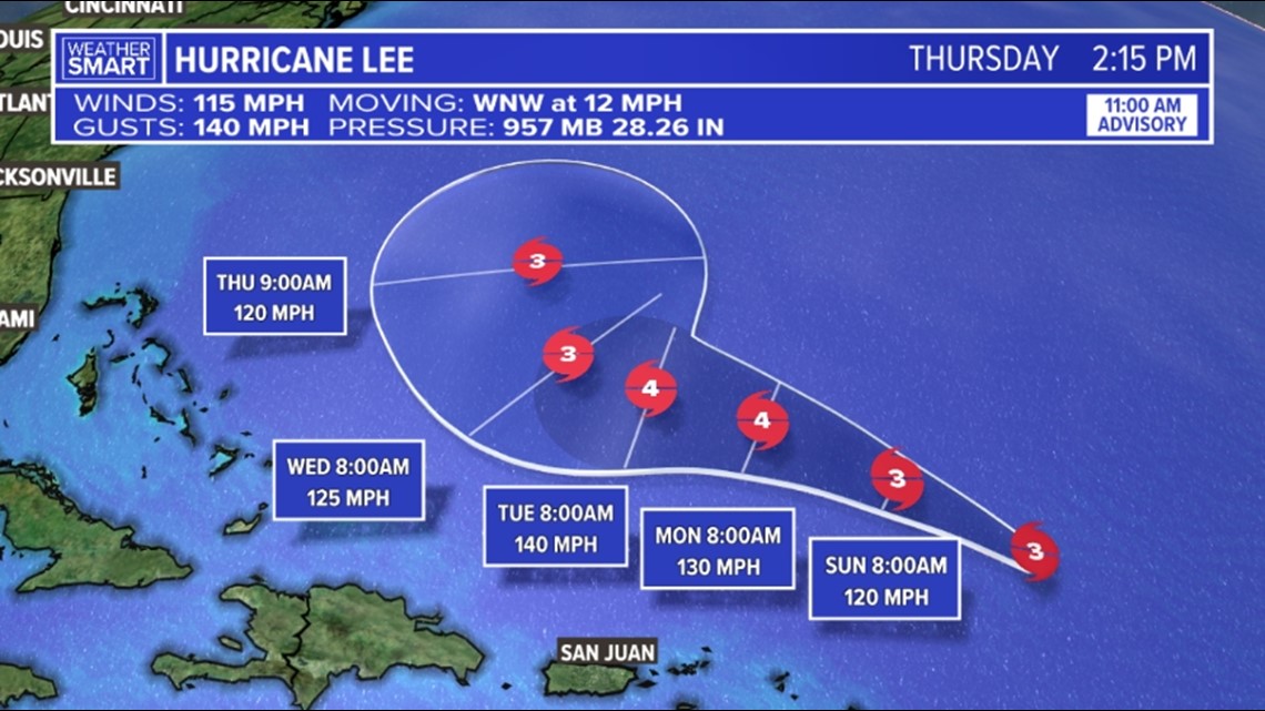
Latest track for Hurricane Lee as of 11 a.m. Saturday morning.
The latest forecast track for Lee has it re-strengthening back to a Category 4 hurricane early next week. The storm will stay well north of the northern Leeward Islands, the Virgin Islands, and Puerto Rico. While impacts will be minimal, there will still be dangerous surf and rip currents along these islands through the weekend and early next week.
Towards the middle of the week, most models have Lee curving to the north with no landfall expected in the United States. While impacts currently look minimal to none, we will have to keep an eye along the East Coast for dangerous surf and rip currents. We will also continue to watch Lee as it makes its curve north for any future changes to its track. But for now, there are no big concerns with this storm.
Looking farther out to the east, we now have Tropical Storm Margot in the Atlantic Ocean as well.
Fortunately, with Margot, this storm looks to stay in the middle of the Atlantic and remain a fish storm.
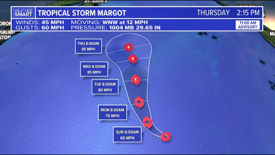
Tropical Storm Margot’s forecast path per the 11 a.m. Saturday update from the National Hurricane Center.
The latest forecast shows Margot gradually strengthening to a Category 1 hurricane early in the week as it continues its northward movement.
No impacts to land are expected from this storm right now.
While South Central Pennsylvania is not expected to be impacted by either Lee or Margot, we will continue to track the tropics through the rest of the season. As we know, we are not immune from storms that make their way to the United States. Continue to stay Weather Smart as we wrap up summer and head into fall!
Source : Fox43


